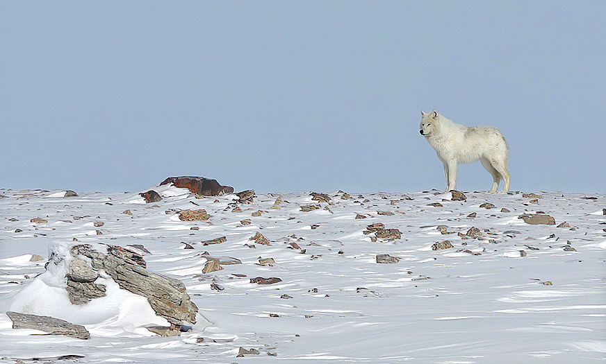
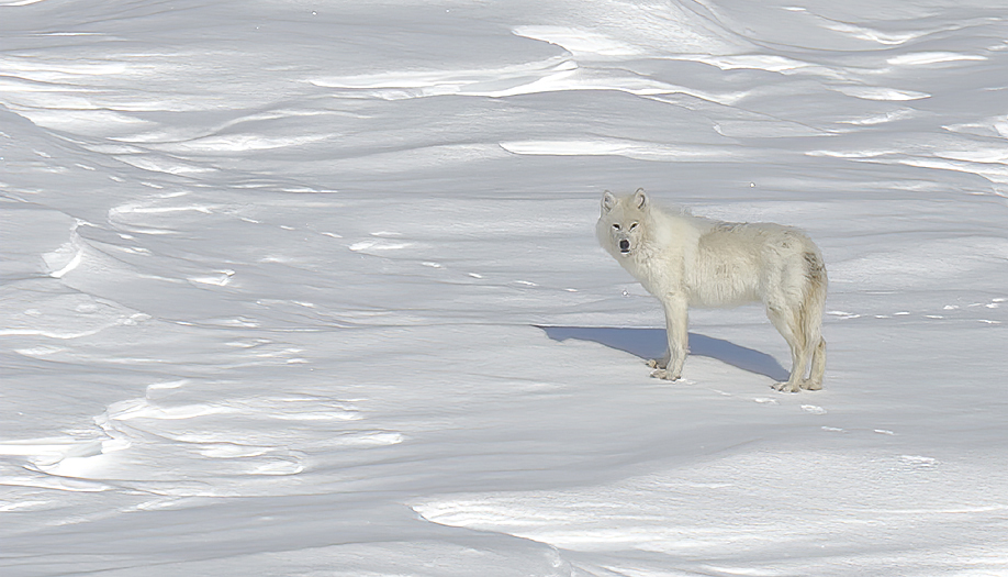
MEMORIES FROM A JOURNEY TO THE WHITE LAND OF ARCTIC CANADA
Foreword
Arctic Canada with its archipelago is the biggest high arctic area on earth. For thousands of years it has been inhabited by inuits,- specialists of human survival in the extreme cold climate of this land. For centuries the White Man tried to pass through and explore these huge and hostile waters. Some succeeded, but many did unfortunately not. Many still lies up there in their eternity sleep. Even if big parts of the land is classified as desert, the wildlife is rich with complete ecosystems.
Many places are rarely visited by man, and our natural born curiosity make such areas act like a magnet for some of us. The following report is from a journey to an area in the western arctic that very few photographs have been published from: The land of Victoria Islands NW part. Victoria Island is the 8th biggest Island (217 000km2) in the world, -slightly bigger than the island of Great Britain. Its population is 1875 persons per year 2008, were most people live in the settlement of Cambridge Bay on the islands south east side.
Arrival to the big freezer
After a long northbound travel, delayed two days by an arctic blizzard, the plane finally landed on the little airstrip outside the inuit settlement of Ulukhaktok. Both land and sea are totally frozen and snow covered. Fresh & sharp air sweep my face when I leave the plane. The thermometer show -27°C. Arctic here come the Kabluuna! (Inuktitut word for the White Man. Directly translated “Big eyebrows”)
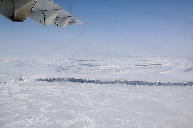
An impressing landscape with cliffs straight up from the frozen sea ice meet me when I arrive the west coast of Victoria Island.
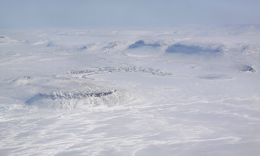
From the air I clearly see the small community of Ulukhaktok.
The people who live here in Ulukhaktok are called Ulukhaktokmiuts (“people of”), and contains approximately 400 persons. The large bluff overlooking the settlement contains slate and copper, and the inuits have for centuries used this for making tools. Ulukhaktok mean “The place were ulu parts are found”. The inuits here at the Coronation Gulf was of this reason earlier named “Copper Inuits” (or Kitlinermiuts), this because of their extensive use of artifacts made from native copper deposits of the whole region here (Banks and Victoria Island, and also the adjacent mainland). In the old days, the Copper Inuits during the winter time lived in large snow-house communities on the sea ice due to their main food source was seals. In summer they moved to the inland of the islands and mainland in search for caribou, muskoxen and fish.
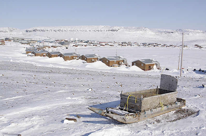
At last I finally arrived Ulukhaktok.
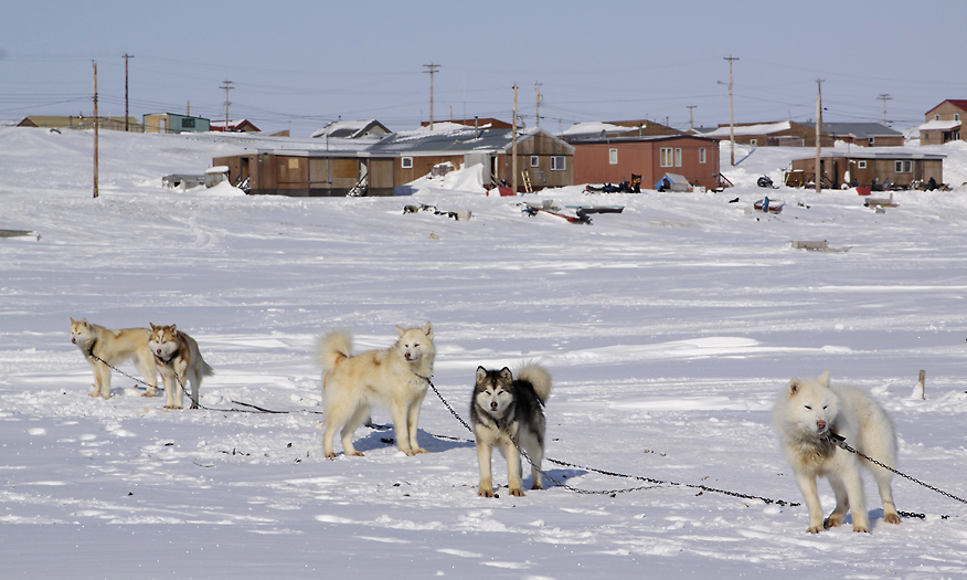
Some inuits still use dog sledge for transport.
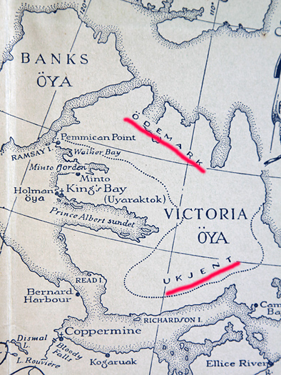
A book named “INUK” was published in 1951. The attached map was then up to date. It is interesting to read that the words “Unknown wilderness” figured at that time… (underlined with red colour and translated from Norwegian)
Like other small traditional communities in arctic Canada, hunting, trapping and fishing are the major way of living. This is obvious when we see what lie outside the individual homes; Hides of Polar Bear, Muskox, seals and Caribou. Horns & antlers, trapped Arctic Foxes. I say hello to hunter Robert Kuptana, he is working with his new harpoon for seal hunting. The harpoon head itself he make of Muskox horn. The people are very friendly and I understand that they are happy here in this small community.
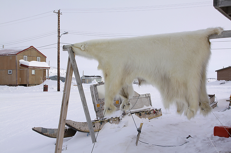
Polar Bear hide outside the homes of Ulukhaktok show what we already know: This is a typical inuit hunting & trapping community.
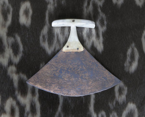
Traditional ulu from Ulukhaktok made of copper and bone.
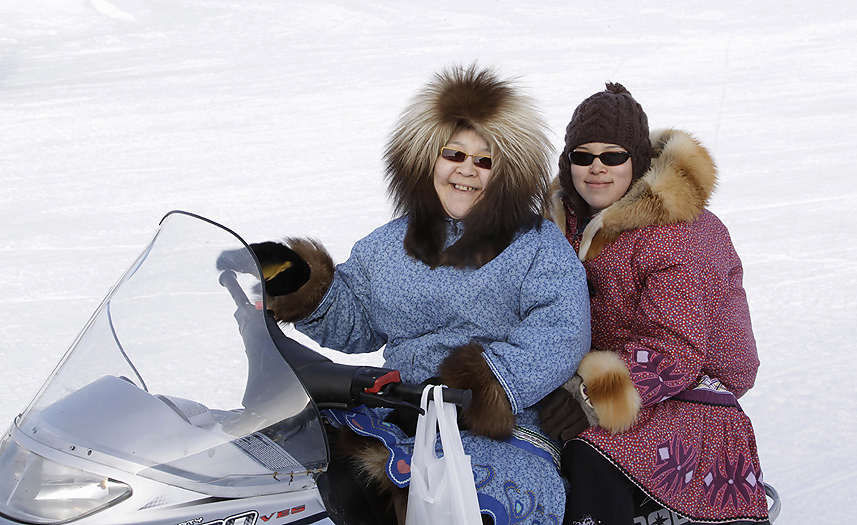
Two smiling young ladies. Also typical for Ulukhaktok; nice and friendly people.
My intention with with this travel to Victoria Island is to make a travel out on the land,- photograph and document wildlife, landscape and the way the inuits navigate & survive in the harsh and winterly climate. Of course will both historical and archaeological sites also be of interest even though they can be hard to find since the land is snow covered.
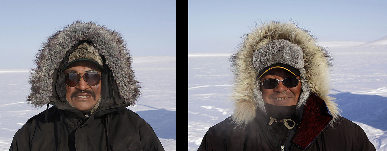
On beforehand my friends and guides Jack kataoyak and Buddy Alikamik have prepared themselves and the equipment needed for the journey that lie ahead of us. Food supplies have been bought at the local Co-op, Bannock bread have been baked and gasoline & oil for our snowmachines have also been bought. Spare parts to the snowmachines and cooking/heating equipment, spare winter clothing & kamiks and other important equipment have been loaded onto the big sledges. The sledges (1 x 5m) are wooden and home made. There are no nails to find in them, only ropes holds them together. Using nails would rather soon caused them to fall apart due to vibrations on the trail.
My good friends and guides Jack Kataoyak and Buddy Alikamik from Ulukhaktok.
Out in the wilderness
The early morning of April 17th 2009 we start our snowmachines and set out on the land. The weather is perfect, with sunshine and no wind. The air is clear and razor sharp, -23ºC. Ahhh,- what a wonderful feeling to be out on the land, and in such a beautiful arctic landscape! Due to the recent blizzard all old tracks are covered now. This is very good because we will now have a situation with only fresh wildlife tracks. The first 10-20km we see very few tracks. The wildlife have here been hunted down of people from the community. But when hours pass and we come further north we see more and more tracks; of Arctic Fox, Hare, Wolf and Caribou. A pure white Snowy Owl hunts for lemmings just beside us.
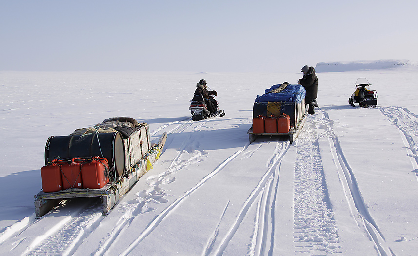
Our first break.
Later we stop for a break beside an Inukshuk. The Inukshuks are landmarks/guides made of stone and placed on strategically places. They might be hundreds (in some cases thousands) of years old and are still in use. When navigating, the inuits do not use map & compass, nor GPS. Well,- some “modern” inuits have got GPS`s in recent years. Regarding using compass, -it would be difficult to use anyway because of the big deviation since we are relative close to the magnetic north pole. The method of navigating is done by ”reading the land”, especially how the snow and snowpatches are placed by the wind (sastrugi). Local knowledge of the land and landscape is of course important.
The normal snow depth is between 1-2 feet. The precipitation many places in arctic Canada is relative small, and in some areas there are less precipitation than in southerly sandy deserts. This time of the year the weather conditions are very often sunny and stable. The sea ice still have winterly thickness, and this is also the fact for all rivers and lakes. Together with long days & short nights,-it make this time of the year ideal for doing such a travel as we do now.
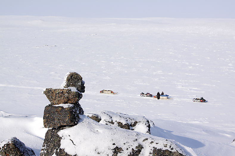
Even today the inuits use Inukshuks as landmarks when travelling out on the land.
On the snowmachines again. We still have some hours left before we reach the place we have planned to stay overnight. The landscape changes to more rugged terrain. Both plains and steep hills with bluffs and talus below make the landscape even more beautiful. It is a pleasure to see how Jack and Buddy handles their big wooden sledges. They are towed by a 8-10m long rope connected to the snowmachine. When driving down hillsides it is interesting to see how they avoid to get a “free running” sledge hitting the back of the snowmachine. Downwards they place the snowmachine slightly aside of the sledge path so that it will not hit the snowmachine in case of a bigger speed of the sledge than the snowmachine. They turn their head and look at the position of the sledge every 5-10 seconds. In bumpy hills with uneven gradient they frequently use their snowmachines for repositioning the sledge. I ask Jack: “How often do You get the sledge bumping into the back of the snowmachine when driving downward steep hills? Oh,- it happened only once, and that was in my youth”. This is clever people I think for myself. Luckily I do not drag any sledge on this journey…
Muskoxen
Far ahead of us we suddenly see many dark dots in the pure white landscape. We drive a little closer before we stop for a look with our binoculars. A herd of Muskoxen! And a km away we see a second herd of these fascinating animals. I say to Jack and Buddy that we have to make a stop here for photographing them. In my opinion wildlife does not necessarily have to be close up for making good photos. Close ups are mainly for documentation of the species itself, but an animal or a bird in a beautiful and interesting landscape make definitely the best photos for big prints. But if the landscape is flat and not especially interesting it is wise to try to get closer. If possible, try to get a foreground into the image, even if it only is some rocks or patches of snow partly shadowed, -this will create a photo with feeling of depth and dimensions.
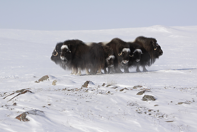
Our first meeting with the Muskoxen. What a sight !!
An hour or two later we continue our journey in this arctic wilderness. We are heading inland and more eastwards now. In this cold weather it is important to cover all naked skin while driving, otherwise there are big chances for frost injuries. But properly dressed it is a pleasure riding these machines up here.
Late afternoon we finally reach our camp. It is a small rustic cabin beside a lake called Fish Lake. People from the community some times drive up here in fall time for fishing Arctic Char. The land are snow covered in October month and the lake is covered with one foot ice late in October. The fishing methods are always the same here in the arctic; fishing with nets under the ice. Arctic Char is preferred over the Lake Trout that often is given to the dogs.
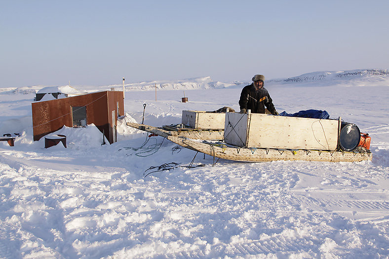
Jack beside our first camp at Fish Lake. The big sledges are voluminous and can carry at lot of equipment.
Clearing the entrance door for snow we step inside for a cup of coffee and relax a bit before we plan to take a trip around the lake looking for wildlife.
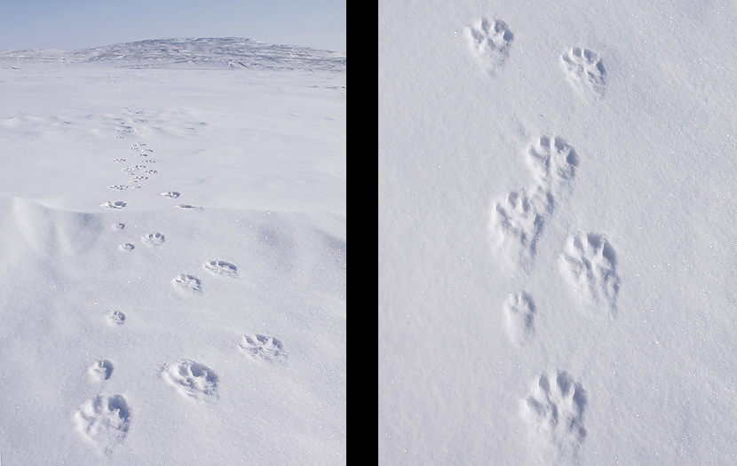
After the break we go outside and disconnect the sledges from the snowmachines. Only 50m away we suddenly discover fresh tracks of 2 wolves just passing by. The must have been here while we relaxed inside the cabin!
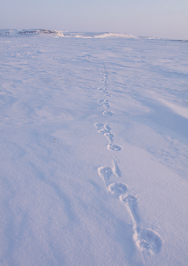
Fresh Wolf Tracks in evening light close to our cabin at Fish Lake.
We follow the wolf tracks and hope to see them ahead of us. But wolves are extremely smart and do absolutely not like the sound of snowmachines, so the chances of seeing them are not so great. We encounter several herds of Muskoxen and also observe a lot of fresh wolf tracks in this area. It is obvious that there is a pack of wolves here that hunt Muskoxen. I am interested in which subspecies of wolf that inhabit this land. Is it the Arctic Wolf (Canis lupus arctos) or the Tundra Wolf (Canis lupus nubilus) ? I have not found anything about this in the literature and want to see myself before I suggest what specific subspecies this can be. A special subspecies named Canis lupus bernardi inhabited Victoria and Banks Islands in earlier days. This wolf, described as white and black-tipped hair along the spinal ridge, became extinct sometime between 1918 and 1952. We are so close to the wolves now that there are still some warmth in the tracks left (he-he !!) after them. The wolves escaped by climbing up some steep hills ahead of us.
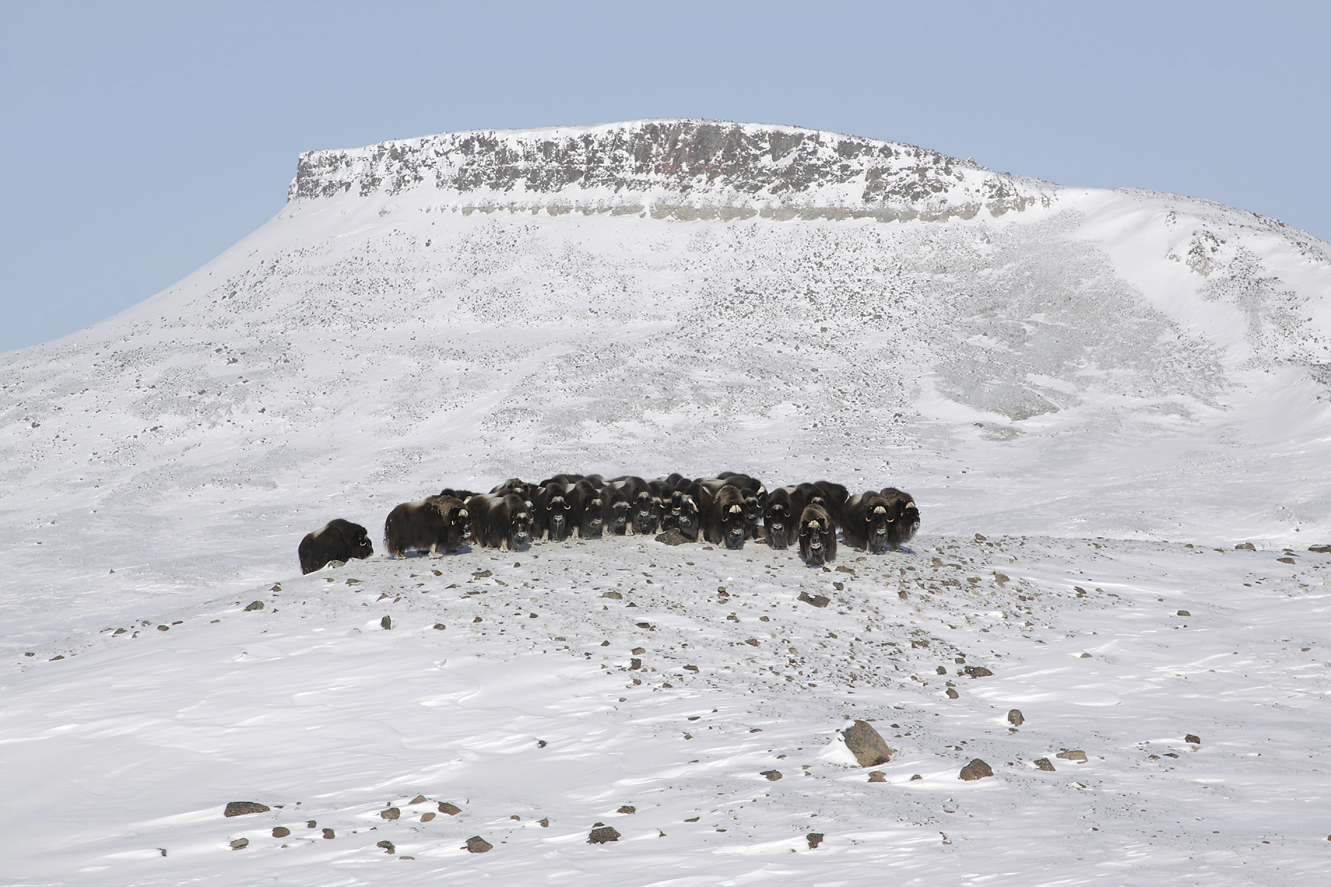
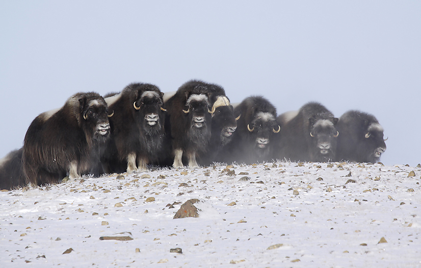
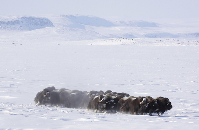
I have travelled a lot in the arctic, seen many Muskoxen and Wolves. But I have never seen Muskox herds that form “defense position” so quickly as they do here. This means that they are under constant pressure of wolves. If the Muskoxen do not find any hill they can run up to and form this defense position, they will form a circle and run circularly. Just as the domestic reindeer in Scandinavia and Siberia.
Muskox herd in defense position.
The Muskoxen are easily scared due to the presence of Wolves.
The land here around Fish Lake is so beautiful and rich of wildlife that we decide to stay here for a couple of days. We count the the different Muskox herds in this area to contain in total about 200-300 animals.
Jack and Buddy says that in the summer time they can find nesting Snowy Owls here. Arctic Foxes also den near by.
Northwards
Our plan is to travel far north, so one morning we load our equipment onto the sledges again and prepare for a long snowmachine ride. The weather seems a bit unstable this morning with fog over the mountain range south of us. In case of a weather change we decide to wait a bit before we head northwards. A very thin fog reach us within a short hour as so called “Ice fog”. Thousands of extremely thin ice needles are “sailing” in the air with the wind just in front of us. They appear to be 4-5cm long and only with a fraction of a single hairs thickness. They are so light-weighted that we cannot feel them hitting our faces. In addition to the fog there also appear “Sundogs” at the sky. “Sundogs” is a small bi-sun at each side of the sun and is the sign for windy weather.
The fog over the mountain tops have now sunk down and cover the landscape completely. We start the cooker inside the cabin again and make us tea and coffee. The temperature inside is rising again and we can remove the warm outer clothing. Good biscuits and interesting talks make hours to go.
Some hours later we are lucky to observe that the fog and “Sundogs” disappear,- and the blue sky is returning.
We drive down the ice covered Kuuijua River (which mean “Big River” in Inuktitut) and ends up on the sea ice of Minto Inlet.
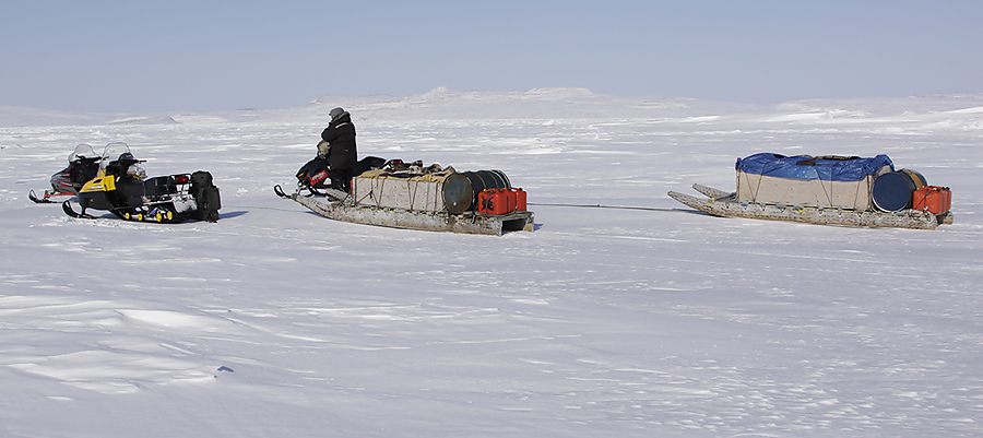
Before crossing the wide Minto Inlet.
This winter have been a “normal” winter with cold & stable weather without too many blizzards. This is obvious to see when we cross the huge Minto Inlet because the sea ice is relative flat without severe obstacles in form of solid frozen ice chunks stacked up. Despite this,- one of the snowmachines loose a belt wheel out one the hard ice. But it`s no problem, such wheels are among our spare equipment.
Some hours later we enter the outer north side of the inlet. We are met by beautiful arctic cliffs. Further on we cross Boot Inlet. We observe an increased snow depth in this area. A pack of wolves have only hours ago crossed the land ahead of us. They follow tracks of an Arctic Hare,- and it can look like they have chased it. It is a fact that wolves like the taste of Hare better than Muskoxen, so they can can use quite an amount of energy to catch them!
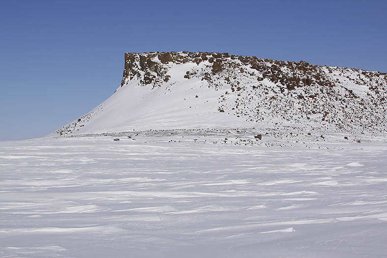
A beautiful arctic landscape met us on the north side of Minto Inlet.
The Wolves have chased an Arctic Hare over Boot Inlet.
Buddy Alikamik know about a special place out here in this polar desert. He lead us to a small oasis where a valley ends out in Boot Inlets north east side. A “wood” of up to 4m high arctic willows grow here. Arctic Willow (Salix polaris) is in fact a tree by all the usual definitions, even changing the colour of its leaves in autumn as do more southerly deciduous trees. We see numerous tracks from Arctic Hare and Arctic Fox in and around this “wood”. We stop here for a break with coffee and some biscuits. There is no wind at all, and we can take off our hats and feel the sun is warming a bit. A Bearded seal is also sunbathing beside its breathing whole out on the bay. Ahh,- what a wonderful life !
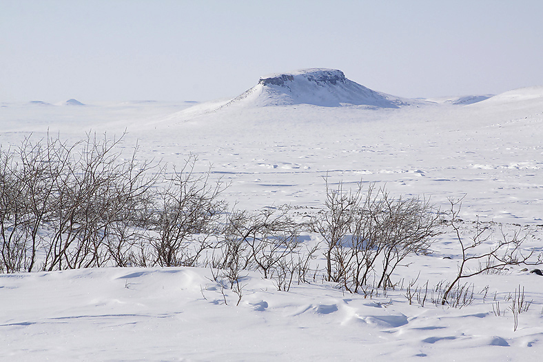
What an odd thing out here in the polar desert; a wood of Willow !
Further north as we drive against Walker Bay we pass herds of Muskoxen and more Wolf, Fox and Hare tracks. We have still not seen any Caribou. We are in the range of the Peary Caribou now. Two subspecies of Caribou exists on Victoria Island; the endangered Peary Caribou (Rangifer tarandus Pearyi) and the some bigger Caribou (Barren ground caribou) of the “Dolphin and Union Strait“ herd (Rangifer tarandus groenlandicus).
The Peary Caribou have their southernmost range here on NW Victoria Island. They are smaller and paler than the nominate race and tends to be solitary or form small herds of three to five animals. The Peary Caribou have had a decline all over the Canadian arctic islands, and the population have been reduced about 75-80% in the last 4 decades and count per 2005 about 10.000 animals. The decline is mostly because of severe icing episodes due to changing weather conditions. The population on Victoria Island per 2008 is estimated to be app 700-800 animals.
The Caribou of the “Dolphin and Union Strait” herd winter on the Canadian mainland, and migrate northwards to Victoria Island again in springtime by crossing the Dolphin and Union Strait. Climate change and increased shipping activity may make this ice crossing more dangerous in the future. This subspecies is bigger than Peary Caribou, but some smaller and paler than the “original” Barren ground caribou that live on the mainland year around. Historical the population was 100.000 animals. In the 1920`s they were near extinction. But they recovered, and In the year of 2000 the population contain about 25.000 animals.
Historical grounds
We make a stop at the Winter Cove in Walker Bay. This is historical areas; In the spring of 1845 the British admiralty sent out a big expedition under command of Sir John Franklin with 129 men to map the area and finally find the “North West passage”. The two ships (Erebus and Terror) was last seen by white men at the end of July the same year. In 1848 the admiralty sent two ships in search for the lost Franklin expedition. One of these ships, “HMS Enterprise”, wintered in 1851-52 here in Winter Cove. The sailors from this ship built a cairn early in the winter at the inlet of the Winter Cove. This cairn was meant to show the lost men of the Franklin expedition that Europeans searched for them (written messages were placed inside the cairn). I did personally not know that this original cairn existed, only the one that the RCMP erected in the 1940`s.
As we know from the history books, no men from Franklin`s expedition was ever found alive,- all 129 men died up here in this merciless land.
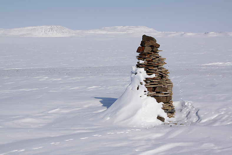
The original Cairn built by the sailors of HMS Enterprise in 1851. Is this the first time it have been photographed ?
We now enter the areas were we have planned to travel around and spend most of our time on our journey. This is a fantastic arctic land, very beautiful and rich of wildlife. Our plan was to stay in tent, igloo and in old hunters cabins. These areas are only now and then visited by people, so we expect to be all alone out here.
Later this evening we disconnect the sledges, make a campsite and head out on the land for a short recognition trip. There are numerous wildlife tracks all over. Most from Muskoxen, but also from Wolves, Foxes and Hares. In the distance we see 2 huge Muskox herds containing more than 100 animals. We head back again to our campsite and prepare us for the night. So far we have been very lucky with the weather, mostly sunshine and little wind. It is a cold evening, when the sun sets around 22:30 hrs, the temperature naturally drop. The light on such cold evenings turn pink-lilac in colour. I mount the Canon Dslr camera on a tripod for capturing this wonderful light. The camera function perfect without any problems down to exactly -33ºC, then the readings from both LCD screens have a delay of app 2 seconds after each action taken. I experience that below -20ºC the batteries loose power relative quickly, and below -30ºC extremely quickly. My method to always be prepared is to wear a vest with 5-6 fully loaded batteries right under my outer-clothing. Then the batteries will at least always have 50% power left and they are easy to reach in a hurry.
In the coldest time of the winter (January & February), it is not uncommon that the temperature can fall down to -50ºC in Ulukhaktok. It is good to know that we are in April month now…
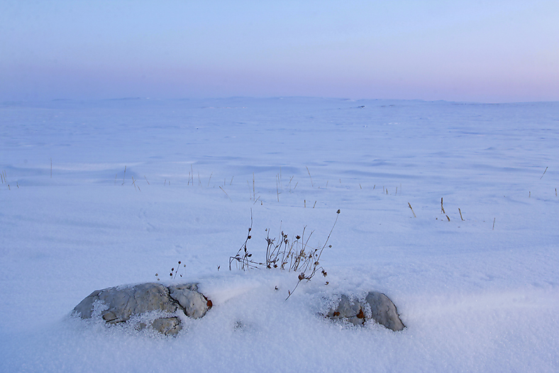
Soft pink-lilac light is typical on cold and clear evenings.
Soft pink-lilac light is typical on cold, clear evenings.
Thule Culture
“We never know what the days ahead will bring”,- so we are always early up in the mornings when the weather is good and use the days fully out on the land. We head inland, and after 5-6km we see a herd of Muskoxen beside a small hill surrounded by relative flat terrain. We stop on top of the small hill for using our binoculars scanning in all directions for other wildlife. Before we reach to find our binoculars we see that there are stone arrangements on this hill. A chain of Inukshuks are placed in a row that lead to a hunting blind. We know that there are several archaeological sites in this area dating to the “Thule Culture”, but we did not expect to see much of them due to the snow covered landscape.
The Thule people (“Thule Culture”) or proto-Inuits were the ancestors of all modern Inuits. They developed in coastal Alaska by 1000AD and expanded eastwards across Canada, reaching Greenland by the 13th century. In this process, they replaced people of the earlier Dorset culture that had previously inhabited the region. The “Thule Culture” period ranged from 1000-1600AD.
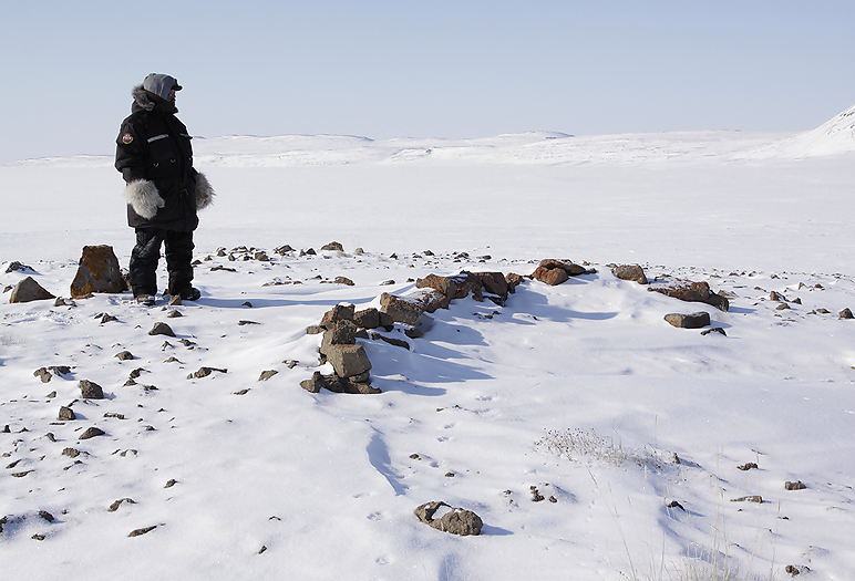
We discovered a hunting blind dated back to the “Thule Culture”.
Wildlife
When travelling out on the land now in the winter landscape we can of course not expect to see any big diversity of wildlife. No migratory birds have arrived, and the different species of mammals are those earlier mentioned in this populated travel report. It is a fact that due to milder climate Grizzly Bears now have reached Victoria Island. In 2008 there were reported so many as 30 sightings of Grizzly Bears on the island. In April 2006 a bear that was an obvious result of interbreeding between Polar & Grizzly Bear was shot south west of Banks Island. On the Canadian mainland Grizzlies are expanding their territory northwards on the tundra. So far on our trip we have not seen any Grizzly Bear,- nor Red Fox that also exist here in very small numbers, only the traditional arctic species as Arctic Fox and Arctic Hare.
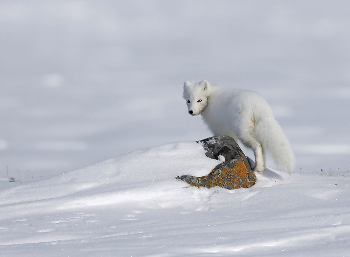
The Arctic Fox is one of the most beautiful animals in the arctic.
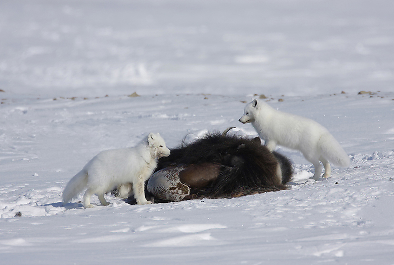
Arctic Foxes feeding on a dead Muscoxen.
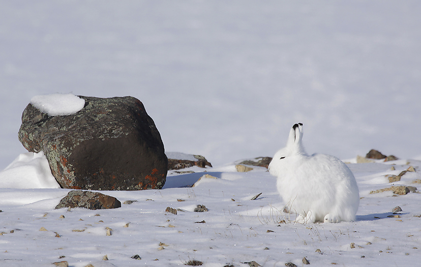
Arctic Hare.
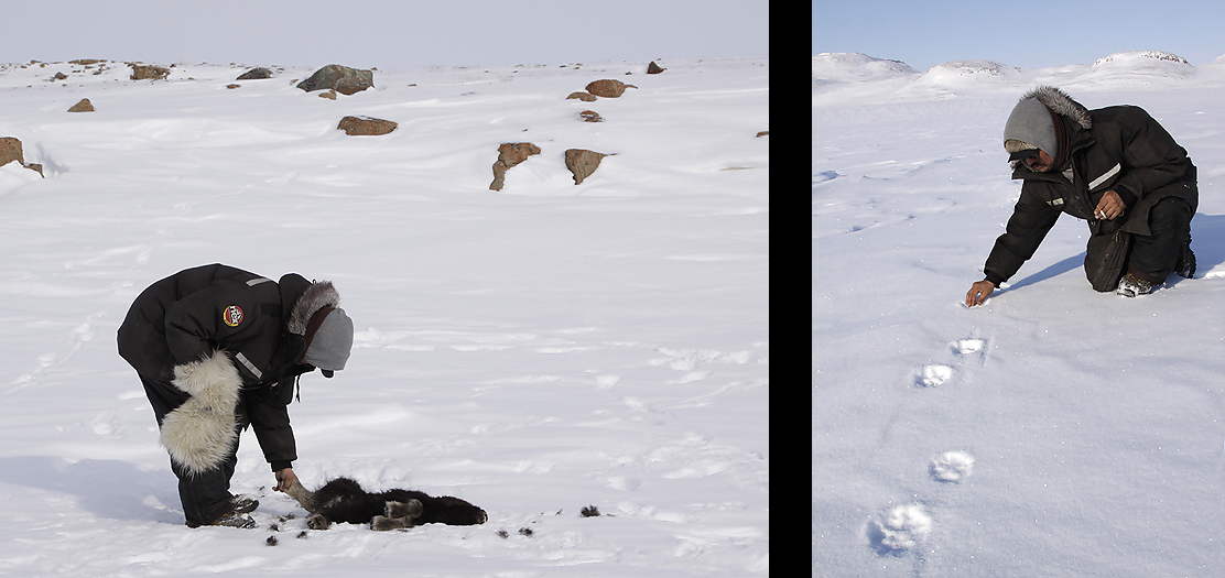
On a typical day out on the land we pass many herds of Muskoxen. Typical each herd containing 10 up to 50 animals. This is the time of the year when the Muskoxen give birth to their calves. It is incredible to witness how these new born calves can survive in temperatures below -30ºC. But it is not the low temperatures that are the threat to the calves,- they are “dressed” for this. Wolves have a food source without exception these days, and are the absolute main threat for the new born Muskox calves. We see fresh tracks of wolves by near all Muskox herds, and also many wolf killed Muskox calves. And close to these wolf kills we see ravens, only then,- without exception. From distance we can sometimes see Muskoxen in defense position or climbing up steep hillsides,- then we know that they are under Wolf attack. One day when we are far away from our campsite we stop and have a look at a killed Muskox calf. The calf is still warm and fresh Wolf tracks go away from the calf. The Wolves must have heard our snowmachines and have run away only minutes before we arrived.
Jack examines a Wolf kill (Muskox calf), and later how fresh some Wolf tracks are.
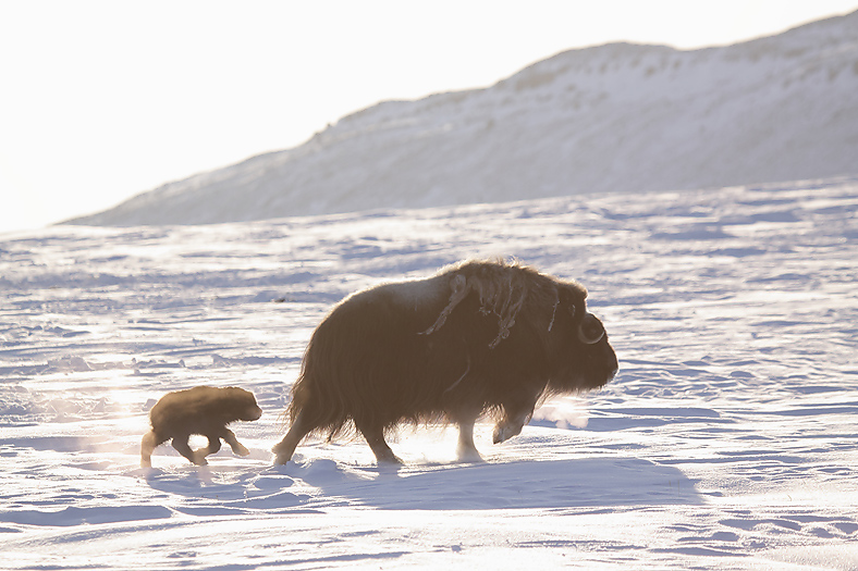
April is the main birth month for Muskoxen.
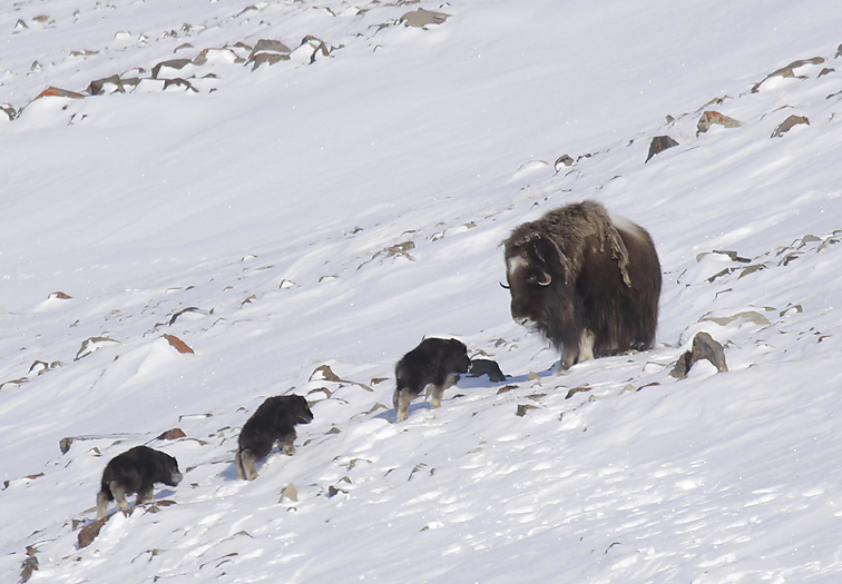
The Muskox mama try to get the calves in elevated position due to Wolf presence.
Another day, up in Jago Bay, when we have turned and drive inwards the bay we see a pack of 10 Wolves attacking a herd of about 20 Muskoxen. They are active and try to separate a two-yearling from the herd. The Muskoxen try to defend themselves by climbing up a hillside, but It is not steep enough for this purpose, so they place themselves in defense position instead (karre`). We slowly approach the scene, but are seen by the Wolves that disappear of this reason. When we are near this Muskox herd we observe the alpha female a km away. She is alone and try to lead us away from the pack. This behavior is well known by my inuit friends Jack and Buddy that says she act as a “Scout”. We encounter her and see how beautiful she is with her light and dens winter fur.
We watch her in 10-15 minutes before she leave us. A bit later we can hear her howl, she seek contact with the pack for joining them again. This was a nice meeting and experience.
After several Wolf sightings my conclusion is that the wolves up here are Tundra Wolves,- not Arctic Wolves.
The female Alpha Wolf tried to lead us away from the rest of the pack.
Female Alpha Wolf.
The Muskoxen here on Victoria Island (and the near by Banks Island) have an interesting history; In the 1950`s they were hardly seen on these islands. Later they were counted,- and what an increase in population; they increased much, much more rapid than what could be theoretical possible. The following example is from Banks Island: From a total population of 100 animals in 1961, to 800 in 1967, 1.800 in 1970, 84.000 in 1994, then down to 58.000 in 2006. Per year 2008 it is estimated a population of 50.000 animals on Banks Island. On Victoria Island it is estimated to be around 30.000 Muskoxen in 2008. Very old and vague stories from inuit elders indicates that for several hundred years ago the Muskox population on these islands was high, but they had moved against the eastern Canadian arctic due to too small amount of food for them here. Now they have returned back again! This is a big source of food both for the Wolves, and the inuits. The inuits in Ulukhaktok are licensed to kill 1000 Muskoxen a year. But Muskoxen are not so regarded as the Caribou by the them, this because the Caribou hide can be used for clothing, some that the ragged Muskoxen are not so well suited to.
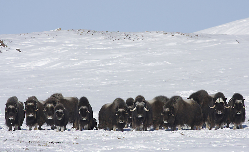
Typical defense position when the Muskoxen are attacked by Wolves.
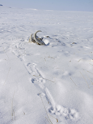
Wolves are curious by nature and check out obstacles where ever they go.
Before the Muskoxen returned back to Victoria Island again, the inuits had to struggle hard for food. Caribou, seal and fish was their main source of food. The community of Ulukhaktok did not exist, and the inuits moved seasonally in small groups to different areas to always be at the best hunting/fishing places at any time.
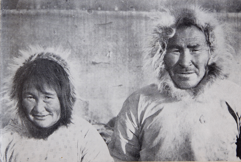
Referring from the book “INUK”: “Old couple from Minto. Long ago they ate human flesh,-now they work at the missionary station”.
Back to the civilization
Days pass, beautiful weather every day, hundreds and hundreds of miles is left behind us on our snowmachines. More than 600 hundred liters of fuel is used by our machines. Dozens of gigabytes with photos are stored on the memory cards. The amount of food is decreasing. We all know that our journey is about to end.
The day to start our travel back to the civilization had to come one day. We have calculated that we have enough fuel to come back again to Ulukhaktok,- and 25 liters in spare for 1 snowmachine in case of an emergency.
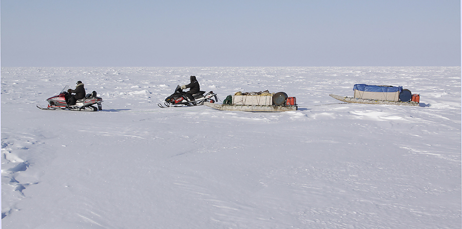
On our way back to the civilization we see south westwards against the Amundsen Gulf. From here there are 2 full days of snowmachine ride to reach open water were Polar Bears occur.
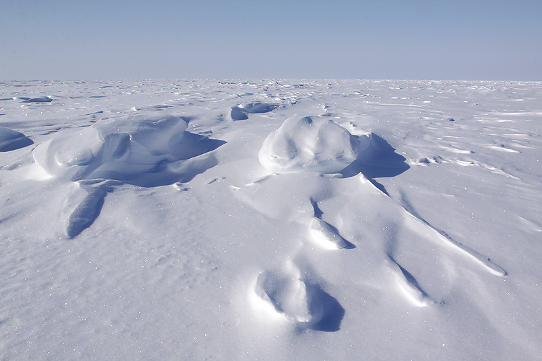
Part of the sea ice on the Prince of Wales Strait.
One late afternoon we finally arrived Ulukhaktok. It is a bit strange to suddenly be in a noisy town (!!). After a looong shower, I am Ulukhaktoks cleanest person (well,- it feels like that…)
Next morning when I wake up in my luxurious warm bed, I look out of the window and see that the weather is cloudy, with wind, and snow in the air. I now understand that the adventure is over and it is definitely time to go home to Europe again. When the plane departed later this afternoon everything under us was white only seconds after the departure.
… 2 weeks after my return home again I talked to my friends in Ulukhaktok. They could among others tell me that the weather had been bad all since I departed the community.
Per Michelsen
Thanks to:
Don Worthington (barrensexpeditions.com)
Jack Kataoyak
Buddy Alikamik
Joseph Haluksit

